DESATERO COOL VÝLETNÍKA
PĚŠÍ VÝLETY
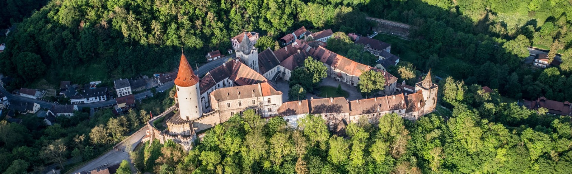
Castles and Chateaus
Observation Towers and Viewpoints
Nature Attractions
Museums & Galleries
Educational Trails and Prilgrimage Routes
Church Monuments
Information Centres
Beroun
Cerhovice
Černín
Dobříš
Hudlice
Karlštejn
Králův Dvůr
Lhotka u Berouna
Malé Kyšice
Mořinka
Nižbor
Svatý Jan pod Skalou
Tetín
Tmaň
Velká Buková
Zdice
Třenická Hora Observation tower
Cerhovice Observation Towers and Viewpoints
An iron telecommunication tower, which serves as an observation tower at the same time, is located near the town of Cerhovice, near Hořovice. The 30 m high tower was built in 2007, The 20 m high observation deck was open for public on 15 September 2007.
The tower offers view of the Cerhovice town, the Czech Karst, Plešive hill or the central part of Brdy Hills.
The observation tower is freely accessible. https://www.cerhovice.cz/cesky/kultura/rozhledna/ Coordinates: 49.8545022, 13.8230931
The tower offers view of the Cerhovice town, the Czech Karst, Plešive hill or the central part of Brdy Hills.
The observation tower is freely accessible. https://www.cerhovice.cz/cesky/kultura/rozhledna/ Coordinates: 49.8545022, 13.8230931

The Millenium Stone
Černín Observation Towers and Viewpoints
The commemorative stones were placed on the top of the Hřibce hill near Černín village in 2004 in honor of the 1000th anniversary of the village foundation.
The village foundation is mentioned in the Kosmas Chronicle.
There is no marked trail leading to the place, but it is very simple to find. Follow the dirth path from Černín village and pass the paddocks for horses to get there. Coordinates: 49.9330733, 13.9833189
The village foundation is mentioned in the Kosmas Chronicle.
There is no marked trail leading to the place, but it is very simple to find. Follow the dirth path from Černín village and pass the paddocks for horses to get there. Coordinates: 49.9330733, 13.9833189

Studený Vrch Observation tower
Dobříš Observation Towers and Viewpoints
The observation tower is located near the Dobříš town. Originally it was a land surveyors six-floored stone tower built in 1942. The tower is 17,5 metres high. Since 2004 it has been used as an observation tower.
The red market tourist trail from Skalka to Jince via Kuchyňka leads to the tower (1,5 km from Jelení Palouky). https://rozhlednastudenyvrch.estranky.cz/ Coordinates: 49.8051078, 14.0831775
The red market tourist trail from Skalka to Jince via Kuchyňka leads to the tower (1,5 km from Jelení Palouky). https://rozhlednastudenyvrch.estranky.cz/ Coordinates: 49.8051078, 14.0831775

Hudlice Rock
Hudlice Observation Towers and Viewpoints
The nature landmark of Hudlice village is a 487 m high hard aggregate rock cliff. The only non-karst cave in the region is situated here and can be accessed from under the face of the cliff. Walk up the wooden steps to the top of the rock with a quirky gun sight installation.
http://www.obec-hudlice.cz/turisticke-zajimavosti/hudlicka-skala/
Coordinates: 49.9592417, 13.9628589

